| This map is found on Mapicurious.com | Download these points of interest directly into your favorite GPS or other geo software | |||
|
|||
| Use the zoom controls on the map to adjust the map's viewable area then print: | |||
| LOCATIONS highlighted on this map: |
|
lat:35.595000 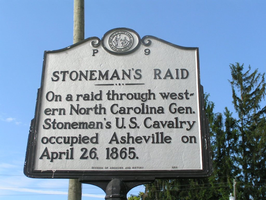
Index page to all North Carolina markers
lat:35.595000 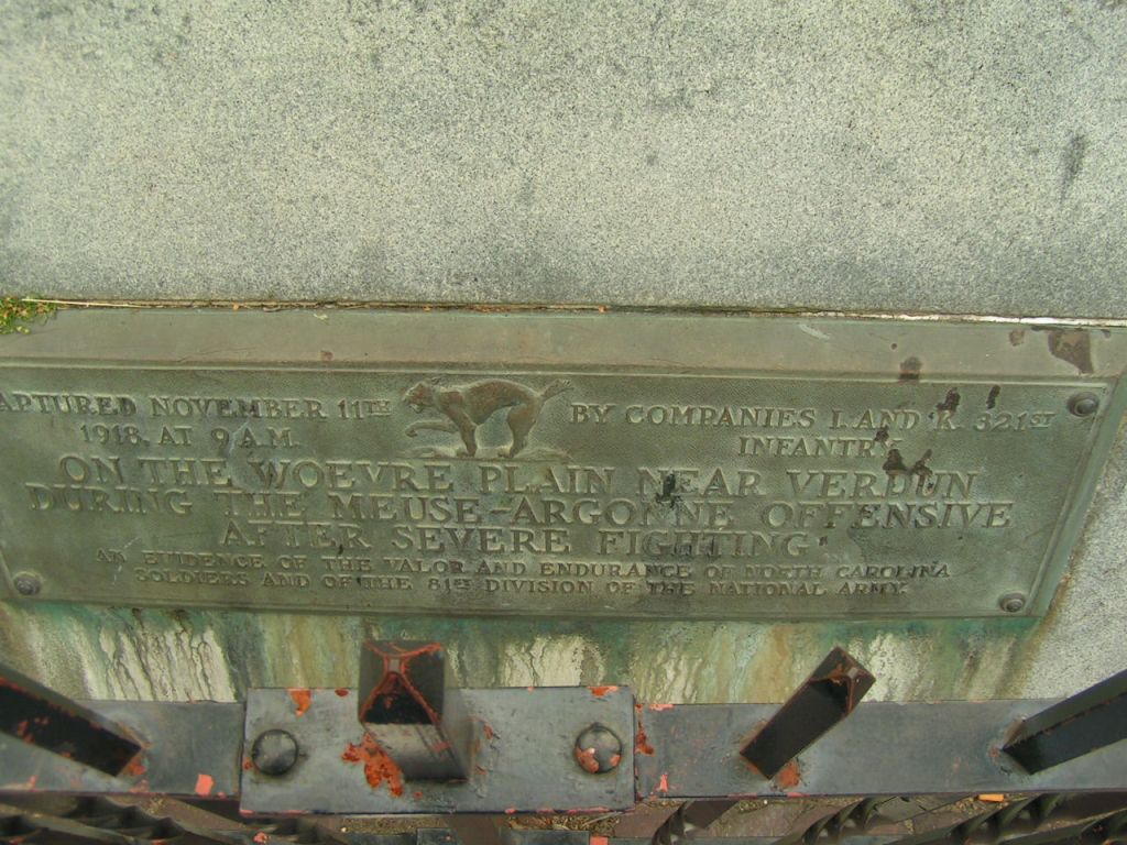
Plaque honoring Companies L & K
lat:35.263611 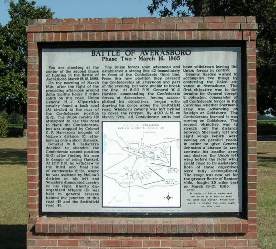
NC 82 north of Godwin at Chicora Cemetery
lat:35.251944 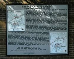
Averasboro Battle Phase I II-3
lat:35.251944 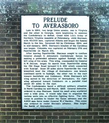
Averasboro Battle Prelude II-2
lat:35.282193 
US 701 and Harper House Rd.
lat:35.885833 
US 64/264 bypass at the Rest Area northwest of Manteo (9/3/05) [35.885833,-75.668056]
lat:35.595000 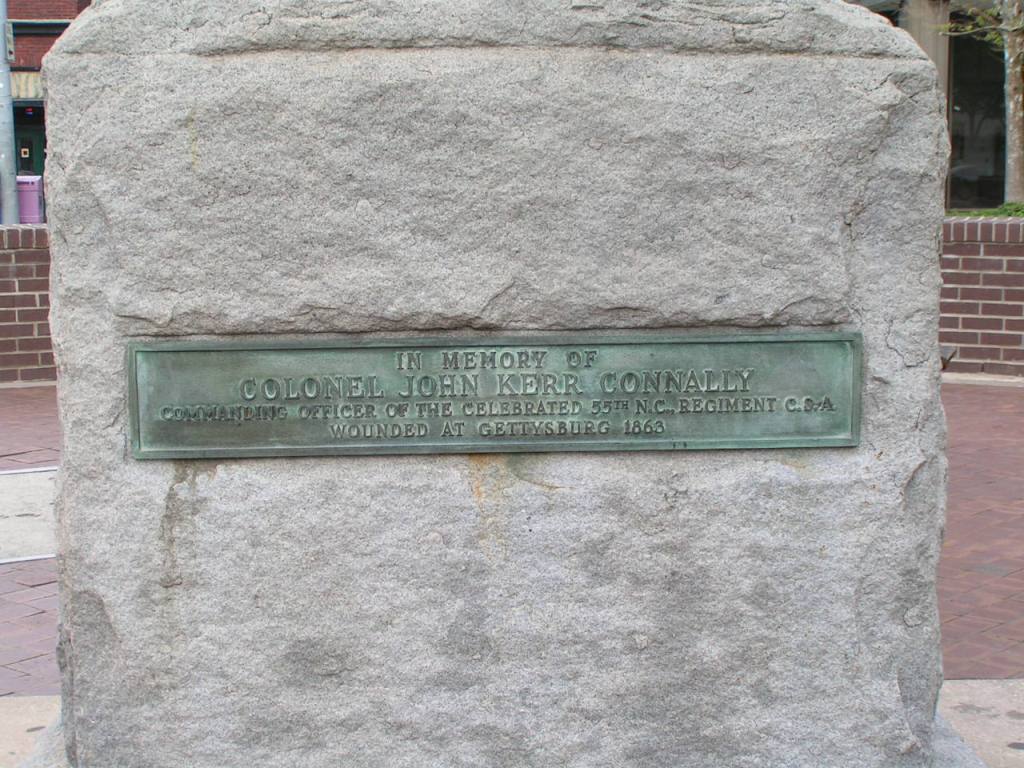
In memory of
lat:35.911944 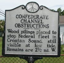
US 64/264 in Manteo (8/30/05) [35.911944, -75.676389]
lat:35.263889 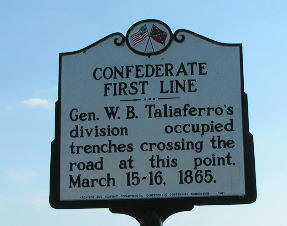
NC 82 north of Godwin
lat:35.665000 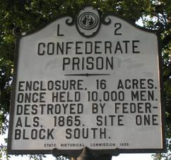
E. Innes St. at Long St. in Salisbury (8/27/05) [35.665000, -80.466944]
lat:35.595000 
Erected and dedicated to
lat:35.251944 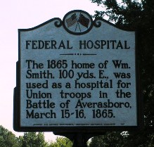
NC 82 north of Godwin
lat:35.911944 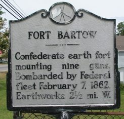
US 64/264 in Manteo (8/30/05) [35.911944, -75.676389]
lat:35.927778 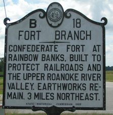
NC 125 NW of Williamston at Ft. Branch Rd. (8/27/05) [35.927778, -77.203056]
lat:35.885833 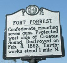
US 64/264 at Manns Harbor (9/3/05) [35.885833, -75.761111]
lat:35.926944 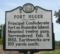
US 64/264 at S/E end of bridge in Manteo (8/30/05) [35.926944, -75.723333]
lat:35.911944 
US 64/264 at S/W end of bridge in Manteo (8/30/05) [35.911944, -75.768333]
lat:35.263889 
NC 82 north of Godwin
lat:35.619722 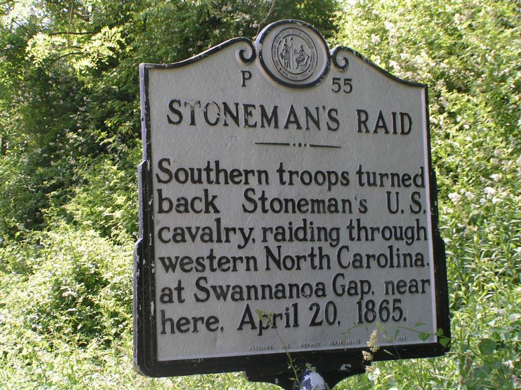
(5/28/05) [35.619722, -82.280000]
lat:35.554722
(5/27/05) [35.554722, -82.538889]
lat:35.595000 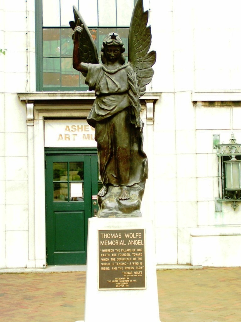
“Look Homeward Angel”
lat:35.263889 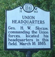
NC 82 north of Godwin
lat:35.595000 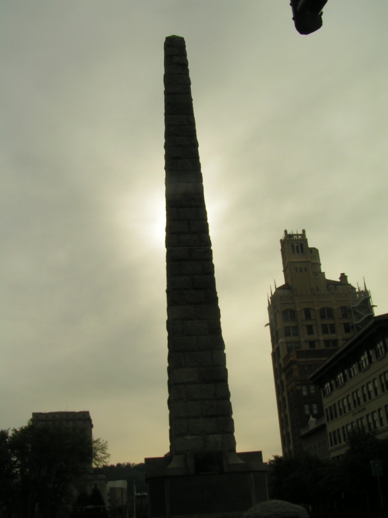
Zebulon Baird Vance Obelisk
|


|
Although the author has taken all reasonable care in preparing this guide, Mapicurious and the author make no warranty about the accuracy or completeness of its content and accept no responsibility for any loss, injury, or inconvenience arising from its use. |